FAQ
Map Views
We have three different maps available to view on the web site, which can be accessed by clicking the  icon on the map.
IW ROW
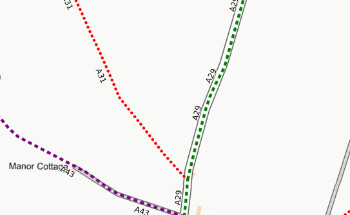
The only paths shown on this map are designated Rights of Way. The ROW data to produce this map is taken from the Isle of Wight Council Rights of Way Department, overlaid onto a basemap from the Ordnance Survey.
- It should be noted that the route of the paths shown on this map do not always correspond to what will be observed in 'real life'.
- The data for this map will be updated infrequently (last update: Sept 2025).
WightPaths
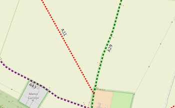
This map shows the same paths as on the OpenStreetMap map (see next panel).
- Rights of Way are shown more clearly than on the standard OpenSteetMap map and our map also shows the Rights of Way reference numbers.
- The style of this map is "experimental" and changes to the design can be expected.
- The data for this map will be updated periodically. This layer was last updated on: 06 July 2026.
OpenStreetMap
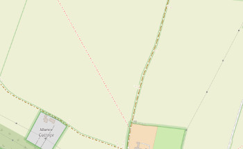
This map shows designated Rights of Ways, and many other paths including permissive paths. This map is not produced by us, but by the OpenStreetMap community.
- The route of the paths shown on this map tends to be closer to whats is observed in 'real life'.
- The data for this map is usually updated constantly.
Rights of Way References
The RoW references (eg BB10) were originally given when the survey for the definitive map was conducted during the 1950's. Each parish was assigned a one or two character reference code, and each RoW within their area of responsibility then had a sequential number added to this code. It should be noted that the coding is based on parishes as they existed in 1952, there have been changes to the parishes since then, but the 1952 parish boundaries continue to be used for RoW referencing. The parish boundaries can be seen in the image below, on on our interactive map by clicking the layer control (icon in top right of map window) and clicking on "Old parishes".

The 1952 parish references are as follows: A (Arreton), B (Brading), BB (Bembridge), BS (Brighstone), C (Chale), CB (Calbourne), CS (Cowes), F (Freshwater), G Gatcombe, GL (Godshill), N (Newport), NC (Newchurch), NT (Niton & Whitwell), R (Ryde), SS (Sandwn & Shanklin), S (Shalfleet), SW (Shorwell), T (Totland), V (Ventnor), Y (Yarmouth).